Water
"According to a popular Dutch theory, water has shaped the Dutch national identity. The Dutch ifght against the water would have stimulated perseverance, ingenuity, cooperation and an egalitarian and democratic society. Despite the long water management history of the Netherlands, water became an important part of the self-images of the nation only in the eighteenth century. In the 1780s the idea that the Dutch had wrung their country from the sea became popular. Initially, this idea was especially popular among the (proto-) liberal opposition, who emphasised the importance of the nation and its achievements. By the end of the nineteenth century, water had become a national symbol for orthodox Calvinists, Roman Catholics and Socialists too, despite their diferent views on the nation. Whenever there was fast social change, political turmoil or external threats, as in the late eighteenth century, the 1930s and 1940s and since the 1990s, the link between water and the Netherlands was used to promote national pride and unity and stimulate action."Erik Mostert, "Water and National Identity in the Netherlands: The History of an Idea," Water History 12, no. 3 (2020): 311–329.
The flood-prone areas of the Netherlands consist mainly of alluvial plainsAn alluvial plain is a flat or gently sloping landform created by the deposition of sediment carried by rivers or streams over a long period. These plains are typically found adjacent to rivers, where periodic flooding distributes layers of silt, sand, and other sediments across the landscape. As a river slows down upon reaching flatter areas, it loses the energy needed to carry heavier sediments, depositing them gradually to form rich, fertile soils. Alluvial plains are especially suitable for agriculture due to these nutrient-dense soils, and they often support diverse ecosystems. formed from sediments deposited over thousands of years by rivers and the sea. Around 2,000 years ago, extensive peat swamps covered much of the region. Coastal dunes and natural embankments shielded these swamps, preventing drainage and protecting them from sea erosion. The low-lying areas in the northern and western parts of the country were dominated by extensive peat swamps. Though these swamps were not technically underwater, they were saturated with water, making them unsuitable for permanent settlement or agriculture.
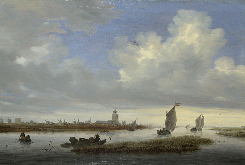
Salomon van Ruysdael
1657
Oil on wood, 51.8 x 76.5 cm
National Gallery, London
Habitable land was limited to higher elevations in the east and south, as well as the dunes and embankments along the coast and rivers. In certain northern regions, the sea had breached these natural barriers, creating expansive floodplains.A floodplain is a flat or nearly flat area of land adjacent to a river or stream that experiences occasional or regular flooding. During periods of high water, the river overflows its banks, spreading water and sediment across the surrounding landscape. This process deposits nutrient-rich silt, sand, and organic material, which enriches the soil and makes floodplains highly fertile and ideal for agriculture. Over time, natural levees or raised riverbanks may form, but floodplains remain susceptible to seasonal floods. Floodplains are ecologically significant, supporting diverse plant and animal species adapted to periodic flooding. As a result, large stretches of land, particularly in the provinces now known as North Holland, South Holland, Friesland, and Zeeland, were largely inaccessible or seasonally impassable due to high moisture levels.
The first permanent inhabitants were likely attracted to these areas by the fertile clay soil deposited by the sea, which was more productive than the peat and sandy soils found further inland. Coastal dunes and natural embankments shielded these swamps, preventing drainage and protecting them from sea erosion. Habitable land was limited to higher elevations in the east and south, as well as the dunes and embankments along the coast and rivers. In certain northern regions, the sea had breached these natural barriers, creating expansive floodplains. The first permanent inhabitants were likely attracted to these areas by the fertile clay soil deposited by the sea, which was more productive than the peat and sandy soils found further inland.
In addition to the peat bogs, vast floodplains formed in the delta of the Rhine, Meuse, and Scheldt rivers. These plains were regularly flooded by both river overflow and tidal movements, rendering them intermittently uninhabitable. Without the protective dikes and drainage systems of later centuries, the rivers often spilled into nearby lowlands during rainy seasons or high tides, further limiting usable land. Along the coast, tidal marshes stretched inland, and seasonal flooding could extend deep into the landscape during storm surges. The western and northern coastal areas, therefore, were highly dynamic, with many parts submerged during high tide.
Estimates suggest that around one-third of what is now the Netherlands was either underwater or saturated with standing water due to river overflow and tidal surges, which extended far inland. While the precise boundaries are difficult to pinpoint, geological studies and archaeological evidence, such as sediment layers and pollen analysis, indicate that at least half of the northern and western regions were waterlogged or subject to frequent flooding. Habitable land was largely restricted to elevated areas in the east and south and along natural ridges like coastal dunes and river embankments. This challenging environment laid the groundwork for the Netherlands' later water management innovations, as early settlers developed a unique relationship with their aquatic surroundings, striving to reclaim and secure land from the water's persistent reach.
Early Beginnings: Historical Progression of Early Water Management
Over the centuries, the Dutch have engineered their landscape to manage the challenges posed by water, reclaiming land from the sea since the medieval period. By the seventeenth century, they had perfected the technique of creating polders (reclaimed land surrounded by dikes).
The construction of dikes, canals, and sophisticated drainage systems has not only reclaimed land from the sea but also safeguarded it. These human modifications have been crucial in shaping the Netherlands' current geography, turning challenges into opportunities and making the nation a leader in water management and land reclamation. This intricate relationship between natural elements and human ingenuity continues to define the Dutch approach to environmental and engineering challenges, embedding a deep cultural emphasis on planning and cooperation within Dutch society.
The Netherlands' relationship with water has profoundly influenced its societal and political evolution. Situated in a low-lying delta, the early inhabitants, notably in Frisia, Groningen, and parts of North Holland adapted to the constant dangers flooding from both the sea and rivers by constructing artificial dwelling mounds known as terpen (or wierden), elevating their homes above flood levels. These mounds, some dating back to 500 BC, facilitated permanent settlements in flood-prone areas were built to protect against the frequent floods and rising tides that threatened the region before the development of sophisticated dike systems. Constructed from materials like mud, clay, and peat, terpen provided elevated, dry land where people could build homes and villages. As communities grew, these mounds became larger, and ometimes joined to form large village terps. Over time, as the Dutch became more adept at managing water through dikes and drainage systems, the reliance on terpen diminished. Many were leveled, with the material repurposed for other construction projects. However, some terpen have been preserved, offering valuable archaeological insights into the lives of early Dutch societies. Many terps were periodically uninhabited, likely due to periods when flooding frequency or severity was relatively high. Some terps were permanently abandoned during these times.
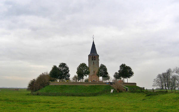
Terp Oosterwierum, located in the Dutch province of Friesland, is a historically significant terp, created to provide a safe, elevated area for habitation in a region prone to flooding . Oosterwierum is near the village of Easterwierrum (Dutch name Oosterwierum), about 17 kilometres south of Leeuwarden (fig. 1). Terps like Oosterwierum were developed centuries ago as practical responses to the challenge of periodic high water levels in low-lying coastal regions. The structure and use of Terp Oosterwierum, like other terps, were designed to optimize agricultural productivity and habitation security. The church tower was built on a terp in the 13th or 14th century. According to an inscription on the facade, repairs took place in 1589. Fields and farmland were arranged strategically, with elevated areas on the terp serving as residential zones while lower surrounding areas were used for agriculture and livestock. Over time, changes in environmental management, such as dike construction, altered the role of terps, though they remain key historical sites that contribute to our understanding of early adaptation practices to the North Sea's tidal landscape.
By the eleventh century, the construction of larger dikes became more prevalent. These earthwork barriers were built along riverbanks and coastlines to protect communities and agricultural lands from flooding. For instance, the Pingjumer Gulden Halsband, a ring dike near Pingjum in Friesland, dates back to this period and exemplifies early communal efforts in flood defense.
The reclamation of marshlands through drainage systems also played a crucial role in expanding arable land. By the fourteenth century, the Dutch had developed techniques to drain wetlands, transforming them into productive polders. This was usually done near urban and harbor areas, and involved constructing canals and sluices to manage water levels, allowing for the cultivation of previously unusable land. Smaller strips of land were reclaimed by filling with sand or other types of land materials. This was usually done near urban and harbor areas since the fourteenth century. For instance, Amsterdam and Rotterdam were expanding in this manner. The development of using windmills for pumping water in the fiftenth century allowed the draining of significant bodies of water. This resulted in the creation of polders. The first steam powered water mill was put to use in 1787.
These early water management practices not only safeguarded the land but also fostered a culture of communal responsibility and cooperation. The necessity of maintaining dikes and drainage systems led to the formation of local water boards (waterschappen), some of which date back to the thirteenth century. These institutions were among the earliest forms of regional governance in the Netherlands, laying the groundwork for the collaborative political structures that would emerge in the following centuries.
As communities expanded, the need for more comprehensive water management became evident. By the early medieval period, larger dikes and primitive drainage systems were introduced, evolving in response to growing agricultural needs. These constructions were often community-led, necessitating cooperation among residents and setting a foundation for the collaborative water management systems that would become a hallmark of Dutch society. Small, local dikes helped redirect water away from farmland, but they required constant upkeep, reinforcing both a collective sense of responsibility and an awareness of the ever-present threat of flooding. These human modifications have been crucial in shaping the Netherlands' current geography, turning challenges into opportunities and making the nation a leader in water management and land reclamation. This intricate relationship between natural elements and human ingenuity continues to define the Dutch approach to environmental and engineering challenges, embedding a deep cultural emphasis on planning and cooperation within Dutch society.
In addition to dike construction, the reclamation of marshlands played a significant role in early Dutch society. The practice of draining wetlands to create arable land, while beneficial for agriculture, also presented new challenges. The extraction of peat, a commonly used fuel source, led to land subsidence, which increased the vulnerability of these reclaimed areas to flooding. The Dutch thus found themselves in a delicate balance, constantly working to expand their agricultural base without compromising the safety of their communities.
These early water management efforts laid the groundwork for later developments, particularly as local governing bodies began to formalize. Over time, the necessity of communal dike maintenance and drainage initiatives would catalyze the formation of water boards (waterschappen), some of the earliest institutions of self-governance in the Netherlands. This foundational relationship between water management and civic organization foreshadowed the pivotal role these structures would play in shaping the political and social landscape of the United Provinces.
"It is estimated that between 1590 and 1665 almost 100,000 hectaresA hectare (abbreviated as "ha") is a unit of area measurement used primarily in land and agriculture. It is part of the metric system and is equivalent to 10,000 square meters, or 100 meters by 100 meters. One hectare is roughly equal to 2.47 acres in the imperial system, which is commonly used in countries like the United States. were reclaimed from the wetland areas of Holland, Zeeland and Friesland. However, land reclamation decreased significantly after the middle of the seventeenth century because the price of agricultural products began to fall, making land reclamation far less profitable in the second part of the century.
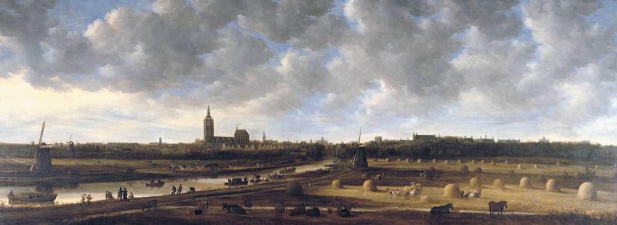
Jan van Goyen
c. 1650–51
Oil on canvas, 174 x 460 cm
Haags Historisch Museum, The Hague
Formation of the United Province
The formation of the United Provinces in the late sixteenth century marked a pivotal moment in Dutch history, as the provinces broke away from Spanish rule, setting the stage for the development of an independent Dutch Republic. Water management played a central role in this struggle for independence, not only as a tool in military strategy but also as a foundation for civic collaboration and political organization. The expertise in controlling water and the infrastructure of water boards—established long before the war—contributed directly to both the defense and unity of the emerging republic.
One of the most significant ways water management influenced the Dutch struggle for independence was through the strategic use of inundations, or deliberate flooding, as a defense mechanism. Facing a powerful Spanish army, the Dutch turned to their knowledge of water to create a unique military advantage. The provinces implemented a tactic known as the "Dutch Water Line," which involved flooding low-lying areas to prevent enemy troops from advancing. By opening sluices, breaching dikes, and flooding entire regions, the Dutch were able to create water barriers that were difficult for Spanish forces to cross. This method allowed the Dutch to turn their otherwise challenging geography into a formidable defense system, directly contributing to their success in the Eighty Years' War (1568–1648).
Beyond military applications, the existing infrastructure of water management fostered a sense of communal responsibility and governance among the provinces. Water boards (waterschappen), some of which dated back to the thirteenth century, were among the earliest forms of regional governance in the Netherlands. These boards were responsible for managing dikes, canals, and other waterworks, requiring cooperation across communities. As a result, the population developed a tradition of collaboration, organization, and decision-making on matters that affected the collective. This experience with self-governance within water boards became an essential component of the civic and political structures of the United Provinces, laying the groundwork for the Dutch Republic’s decentralized form of government.
In the United Provinces, the Dutch created a confederation where each province retained significant autonomy, with political power dispersed rather than centralized. The cooperative model from water boards influenced this approach, as it demonstrated the effectiveness of local control over shared resources. As the Republic took shape, the same principles of shared governance and community responsibility that had governed water management were applied to the administration of the new state. In this way, the Dutch mastery of water not only shaped their landscape but also became a powerful metaphor and practical framework for the governance of an independent nation.
Peat Bogs
What is Peat? Peat is an accumulation of partially decayed organic matter, primarily plant material, found in waterlogged conditions such as bogs, mires, and swamps. It forms when plant debris does not fully decompose due to acidic and anaerobic (oxygen-poor) environments, leading to the preservation of organic material over extended periods. The formation of peat is a slow process, typically accumulating at a rate of about one millimeter per year. Consequently, substantial peat deposits can take thousands of years to develop. For instance, many modern peat bogs began forming approximately 12,000 years ago, following the retreat of glaciers at the end of the last ice age. The Netherlands’ vast peat bogs played a critical role in the development of early Dutch society, providing fuel for heating and cooking, while also presenting complex challenges to land use and agriculture.
Technically, peatlands are significant carbon sinks, storing vast amounts of carbon and playing a crucial role in the global carbon cycle. However, disturbances such as drainage or extraction can release stored carbon dioxide, contributing to greenhouse gas emissions. When burned, peat undergoes smoldering combustion, characterized by low temperatures and incomplete oxidation. This process emits various pollutants, including carbon dioxide (CO₂), carbon monoxide (CO), methane (CH₄), volatile organic compounds (VOCs), and particulate matter (PM2.5), which can have adverse environmental and health effects.
In terms of heating efficiency, peat has a lower energy density compared to coal and wood, resulting in less heat output per unit volume. Its high moisture content further reduces combustion efficiency, making it less effective for heating purposes.
In a country where wood was increasingly scarce due to deforestation, peat provided an accessible and economical alternative, ensuring warmth and enabling local industries to thrive. From the Middle Ages onward, it was used across all social classes due to its cost-effectiveness compared to alternatives like wood or coal. For the lower classes, peat was often the primary source of fuel, especially in regions with easy access to local supplies. The upper classes also used peat, both for heating homes and fueling industries, benefiting from its availability and low cost. While the price varied by region—being higher in areas requiring transport—peat remained an essential fuel, woven into the economic and social fabric of Dutch society. Peat constituted a significant portion of household expenditures, especially during colder months. For lower-income families, this could represent a substantial part of their budget, while wealthier households, despite using larger quantities, would spend a smaller percentage of their income on fuel
The extraction and trade of peat became a robust sector of the Dutch economy, fostering employment in rural areas and creating a network of transport routes for its distribution. Canals were constructed to transport large quantities of peat from inland areas to urban centers, facilitating not only the peat trade but also broader commerce by improving the navigability of the landscape. These peat canals allowed barges to transport goods more efficiently, linking agricultural production sites with urban markets and helping stimulate the Dutch economy
Beginning around the tenth century, as population growth spurred demand for fuel, Dutch communities began to extract peat on a larger scale. Peat, essentially decomposed plant material, could be cut, dried, and burned, offering a vital energy source in the absence of wood in the largely deforested region. However, this extensive extraction of peat soon led to significant land subsidence. As the dried and compacted peat was removed, the land surface lowered, making the area even more prone to flooding—a problem that required increasingly complex water management.
One prominent example of peat exploitation and its consequences is the region of Holland. During the Middle Ages, Holland’s peat bogs were heavily harvested, resulting in a steady lowering of the land level. In some areas, this led to large expanses of land that became permanently waterlogged, giving rise to shallow lakes. These conditions presented a dual problem: on the one hand, the economic need for peat drove extraction; on the other, the sinking land threatened the viability of the reclaimed areas.
By the late medieval period, areas such as the Haarlemmermeer (later reclaimed in the nioneteenth century) had expanded into vast lakes, illustrating how peat extraction could alter the landscape on a large scale.
Land Reclamation
Land reclamation in the Netherlands has a long history, evolving across different periods to meet agricultural and societal demands. In the medieval period, from the tenth to the fifteent centuries, initial reclamation efforts were relatively simple and community-driven. Local populations constructed basic dikes to protect low-lying lands from floods, using gravity for drainage where possible.While effective for small-scale efforts, these early techniques limited the extent of reclamation, as they relied largely on natural water flow and simple barriers.
The sixteenth century marked a turning point in Dutch land reclamation, thanks to the introduction of windmill technology. With windmills now powering pumps, it became possible to actively remove water from marshes and shallow lakes, creating new areas of dry, arable land known as polders. This technological shift allowed for more extensive reclamation projects, as windmills could control water levels much more effectively than gravity alone. However, these techniques were still relatively new and required ongoing refinement.
By the seventeenth century, land reclamation reached new heights with highly organized and technologically advanced projects. The completion of the Beemster Polder in 1612 exemplifies the achievements of this era. Engineers used a sophisticated system of 43 windmills to drain a 70-square-kilometer lake, transforming it into productive farmland. This large-scale project was possible thanks to a combination of improved engineering, economic prosperity, and a rising population’s demand for land. Compared to the medieval reliance on simple dikes and the early windmill experiments of the sixteenth century, seventeenth-century reclamation projects were marked by their organization, scale, and ambition, permanently altering the Dutch landscape. This progression, from rudimentary dikes to vast polder systems, laid the groundwork for the modern Dutch approach to water management, showcasing the nation’s evolving relationship with water across centuries.
Windmills
Windmills played a transformative role in the Netherlands, addressing the country's unique water management challenges and reshaping its landscape. Initially introduced in the twelveth century for grinding grain, Dutch windmills began to serve a broader purpose by the sixteenth century, facilitating large-scale land reclamation. This was particularly vital for a nation where significant portions of the territory were vulnerable to flooding. By harnessing wind power to drain marshes and lakes, windmills enabled the creation of extensive arable land, laying the foundation for Dutch agricultural expansion.
In the seventeenth century, the Netherlands was home to approximately 9,000 windmills. These structures were integral to various industries, including grain milling, water management, and sawmilling, contributing significantly to the nation's economic development during that era (fig. 2 . As of today, around 1,200 of these historic windmills remain standing.
Construction
Dutch windmills distinguished themselves from other European windmills through several key innovations and adaptations. While many European windmills were primarily designed for grinding grain, Dutch windmills were engineered for a broader range of applications, including water management and various industrial processes. The Netherlands' low-lying terrain necessitated effective water control, leading to the development of polder mills that pumped water out of lowlands, aiding in land reclamation and flood prevention. Beyond milling grain, Dutch windmills powered sawmills, oil mills, and other industrial activities, showcasing their adaptability to diverse economic needs.
Structurally, Dutch windmills incorporated features that enhanced their efficiency and durability. The Dutch popularized the smock mill design, featuring a fixed tower with a rotating cap, allowing the sails to be oriented into the wind without moving the entire structure, thereby improving operational efficiency. To optimize performance under varying wind conditions, Dutch millwrights developed sails with adjustable surfaces, employing techniques such as the use of sailcloths or shutters to control the sail area exposed to the wind, enhancing both efficiency and safety.
Advancements in windmill sails further set Dutch windmills apart. Engineers introduced modifications like the Dekker and Van Bussel systems, which streamlined the leading edge of the sails, reducing air resistance and increasing efficiency. The Dekker system involved covering the stock with galvanized steel plates, while the Van Bussel system added a rounded airfoil to the leading edge. Additionally, the Fok system, inspired by the jib sail of a ship, added a curved profile to the leading edge of the sail, creating a slot effect that improved performance in low wind conditions.
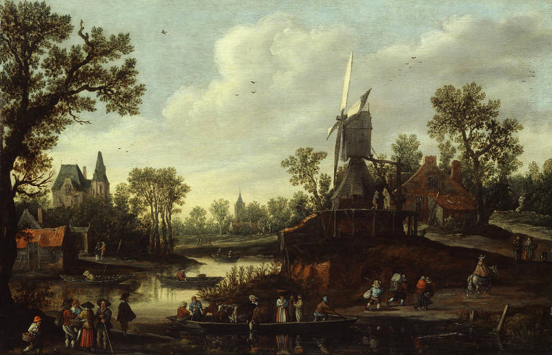
Jan van Goyen
1625
Oil on wood, 42 x 65.5 cm
Bührle Collection, Zurich
To maintain optimal alignment with the wind, Dutch windmills employed advanced orientation mechanisms. Many were equipped with a fantail—a small auxiliary windmill mounted at the rear of the cap—that automatically rotated the cap to face the wind, ensuring continuous operation without manual intervention.
Utility
Windmills offered substantial advantages, such as enabling large-scale land reclamation and supporting various industries, like wood sawing and grain milling, which contributed to the country’s economic growth. Additionally, they became enduring symbols of Dutch cultural heritage, reflecting a tradition of ingenuity and resourcefulness in harnessing natural forces. However, windmills also had limitations. They required consistent wind to operate effectively, leading to performance fluctuations, and regular maintenance to keep them functional. Their efficiency, while remarkable for the time, was limited compared to modern technology, and their presence across the landscape sometimes posed visual and environmental considerations. Despite these drawbacks, Dutch windmills remain an emblem of the Netherlands’ resilience and technological adaptability, representing a legacy of practical solutions to the challenge of living in a flood-prone environment.
Windmills in Dutch Paintings
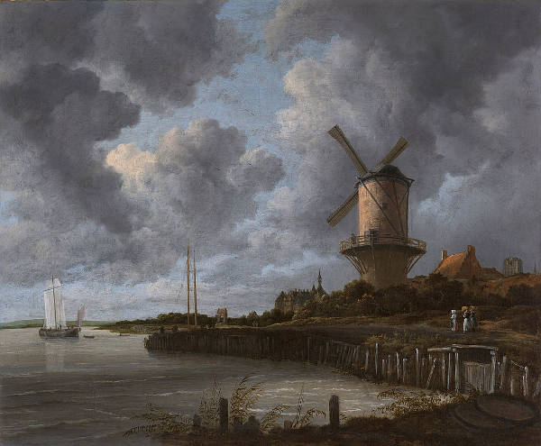
Jacob Isaacksz van Ruisdael
c. 1668-1670
Oil on canvas, 83 x 101 cm
Rijksmuseum, Amsterdam
Windmills have been a prominent subject in Dutch painting, symbolizing the nation's relationship with its landscape and water management. In the 17th century, during the Dutch Golden Age, artists like Jacob van Ruisdael frequently depicted windmills within expansive landscapes, highlighting their significance in daily life and the economy. Ruisdael's The Windmill at Wijk bij Duurstede (fig. 3) is a notable example, showcasing a windmill dominating the scene, emphasizing its importance in the rural setting. Art historians have lauded Ruisdael's ability to encapsulate the essence of the Dutch landscape. The windmill, depicted with remarkable attention to detail, symbolizes the nation's ingenuity in harnessing natural elements for practical purposes. The interplay of light and shadow, particularly in the expansive sky filled with dynamic clouds, demonstrates Ruisdael's mastery in conveying atmospheric conditions and the transient nature of weather. The painting's composition is meticulously balanced, with the windmill serving as a focal point that draws the viewer's eye. The inclusion of human figures, such as the miller standing on the balcony, adds a narrative element, suggesting a moment of observation or contemplation. This human presence, though subtle, enhances the connection between the landscape and its inhabitants
Polders
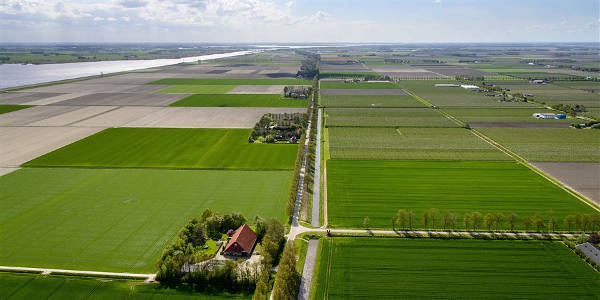
During the seventeenth century, the Netherlands advanced significantly in the creation of polders—tracts of land reclaimed from bodies of water such as lakes, marshes, or coastal seas, enclosed by protective dikes, forming a unique hydrological system. There are three main types: land reclaimed from bodies of water like lakes or the sea; flood plains separated by dikes; and marshes that are dike-enclosed and drained. Due to gradual subsidence, most polders eventually lie below the surrounding water level. Excess water from infiltration, groundwater pressure, rainfall, or rivers is typically removed by pumps or sluices at low tide, with careful management to avoid over-drainage, especially in peat-rich areas, where peat decomposition causes sinking. Polders are constantly at risk of flooding and rely on sturdy dikes, often built from local materials like sand or peat, each with inherent risks. These regions are especially common in river deltas, coastal areas, and former wetlands.
The process of polder formation begins with constructing dikes around the targeted area to prevent water ingress. Once enclosed, the area is drained using pumps and canals; historically, windmills powered these pumps, but modern methods employ electric or diesel engines. After drainage, the land's water levels are meticulously managed through sluices and additional drainage systems to handle inflow or outflow, especially during rainfall or changes in external water levels. Polders serve various purposes, including agriculture, residential development, and industrial use. This method of water management has been pivotal in the Netherlands, transforming previously unusable or unstable land into fertile and valuable terrain, crucial for the country's expansion and economic development.
The Beemster Polder, completed in 1612, exemplifies this ingenuity. Engineers drained a 70-square-kilometer lake using a system of dikes and 43 windmills, transforming it into fertile farmland. The success of such projects was driven by economic prosperity, technological innovation, and a growing population's demand for land.
Dijken (Dikes)
The Netherlands' extensive dijkenstelsel (dike systems) has been instrumental in shaping its landscape and safeguarding its inhabitants from the persistent threat of flooding. Alongside the dikes, the Dutch engineered a kanalenstelsel (network of canals) that facilitated not only transportation and communication across the burgeoning nation but also played a crucial role in controlling water levels The evolution of dike construction reflects the nation's adaptive strategies and technological advancements over the centuries.
In the first century AD, early inhabitants of the Netherlands constructed artificial dwelling mounds known as terpen or wierden to protect themselves from flooding. These elevated areas provided refuge during high tides and storm surges.
By the nineth century, as population density increased and agricultural activities expanded, there was a shift from isolated terpen to interconnected dike systems. Communities began constructing low embankments around fields to prevent inundation, marking the inception of organized flood defenses. The twelveth century witnessed significant advancements in dike construction, exemplified by the completion of the Westfriese Omringdijk around 1250, a 126-kilometer structure protecting the region of West Friesland from the sea.
During the seventeenth century, the Netherlands experienced economic prosperity and technological innovation, which influenced dike construction methodologies. Dikes were primarily constructed using locally sourced materials such as clay and sand. The core of the dike consisted of sand, providing structural bulk, while the outer layers were composed of clay to enhance impermeability and resistance to erosion.
In regions where seaweed was abundant, such as the Wadden Sea area, dikes were reinforced with layers of seaweed on the seaward side. This method provided effective protection against wave action and required minimal maintenance.
To stabilize the foundation and prevent erosion, bundles of brushwood, known as fascines, were woven into mats and placed at the base of dikes, a technique particularly useful in areas with soft or unstable soils. The implementation of dikes offered several benefits. They served as critical barriers against both sea and river floods, safeguarding lives, agricultural lands, and settlements. By constructing dikes around marshlands and shallow waters, the Dutch reclaimed substantial tracts of land for agriculture and habitation, contributing to economic growth.
Despite their benefits, dikes presented certain challenges and risks. They demanded regular inspection and upkeep to address wear and potential weaknesses, as neglect could lead to breaches with catastrophic consequences. Draining reclaimed lands often resulted in soil subsidence, increasing the relative height of water levels and necessitating the construction of higher dikes. Inadequate construction techniques or materials could lead to dike failures; for instance, the introduction of the shipworm (Teredo navalis) in the 18th century compromised wooden structures, prompting a shift to stone reinforcements.
Sluizen (sluices)
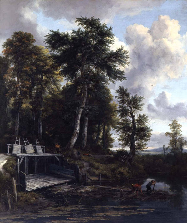
Jacob van Ruisdael
c. 1665-1670
Oil on canvas, 104.1 x 113 cm
Toledo Museum of Art, Toledo
The Dutch engineered a series of sluizen (locks; in Dutch singular sluis), dikes, and drained landscapes to manage water levels and prevent flooding, which in turn facilitated the smooth operation of the trekschuit (tow bardge) routes (trevaarten in Dutch). Tow boat were pulled along canals by horses walking on trekvaarten (tow-boat paths), were an efficient and popular transport solution, pre-dating the railway era and reflecting the Dutch mastery in both hydraulic engineering and transportation. This innovation was closely tied to their sophisticated water control systems, crucial in a country where much of the land is below sea level.
Sluices serve to regulate water levels and facilitate navigation by allowing vessels to transition between bodies of water at different elevations. A typical sluice comprises a chamber with gates at each end. By opening or closing these gates, water flow is controlled, enabling the chamber to fill or empty as needed. This mechanism permits ships to ascend or descend between varying water levels safely.
The Netherlands has a long history of utilizing sluices, dating back to the medieval period. Given the country's extensive network of canals and rivers, sluices have been essential for both flood control and navigation. For instance, the Amstelsluizen in Amsterdam, constructed in 1674, were designed to flush the city's canals with fresh water, improving water quality and livability.
Various types of sluices have been developed to meet specific needs:
- Floodgates: These are used to prevent flooding by controlling the flow of water during high tides or storm surges.
- Navigation Locks: These facilitate the passage of ships between water bodies of differing levels, essential for inland navigation.
- Drainage Sluices: Employed to manage water levels in polders and other reclaimed lands, ensuring that excess water can be efficiently drained.
The construction and upkeep of sluices require meticulous engineering to ensure structural integrity and functionality. Materials such as wood, stone, and, in modern times, reinforced concrete are utilized, depending on the specific requirements and environmental conditions. Regular maintenance is imperative to address wear and potential damage, as failures can lead to significant flooding and associated damages.
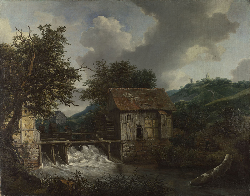
Jacob van Ruisdael
c. 1650-1652
Oil on canvas, 87.3 x 111.5 cm
National Gallery, London
Watermills
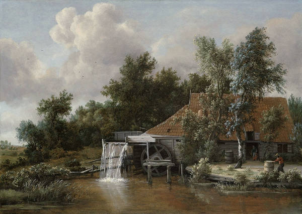
Meindert Hobbema
1664
Oil on panel, 62 x 85.5 cm
Rijksmuseum, Amsterdam
Watermills like this were essential in the 17th-century Netherlands for grinding grain, sawing wood, and performing other mechanical tasks. The painting not only highlights the mill's functionality but also serves as a testament to Dutch engineering and the importance of harnessing water power in the country’s landscape and economy during that period. The scene blends natural beauty with practical utility, capturing the Dutch respect for both nature and technological ingenuity.
Dutch watermills were primarily used to pump water out of low-lying areas, known as polders, into nearby rivers or canals, thus keeping the reclaimed land dry and suitable for farming or habitation. This was particularly important for agricultural expansion, as draining the marshy, waterlogged land allowed it to be transformed into productive farmland. To achieve this, the Dutch developed a specialized type of mill known as the "polder mill," which was equipped with an Archimedean screw or scoop wheel capable of lifting large volumes of water with each rotation. The power generated by wind and water allowed these mills to function efficiently and continuously, particularly in regions such as North Holland, South Holland, and Utrecht, where water management was critical.
Aside from their role in water control, watermills were also used for various other purposes, such as grinding grain, sawing timber, and processing raw materials. This diversity of applications made watermills central not only to water management but also to the economic life of the Dutch Republic, supporting industries that fueled the economy and Dutch maritime activities.
Military Engineering and Strategic Water Use
In the seventeenth century, the Netherlands contended with military challenges arising from its flat terrain and intricate network of waterways. Dutch military engineers responded by developing innovative fortification techniques that leveraged the country's unique geography. Traditional high-walled fortresses proved ineffective in this landscape, leading engineers like Menno van Coehoorn to design fortifications with lower profiles and multiple defensive layers. These designs incorporated bastions, ravelins, and a combination of wet and dry ditches to create complex, layered defenses suited to the environment.
The Dutch strategically employed water as a defensive instrument by creating inundation zones, known as "water lines." Through controlled flooding of specific areas, they impeded enemy movement and protected vital regions. The Old Dutch Water Line exemplifies this strategy, where the manipulation of sluices and dikes allowed for precise control over water levels. This method required sophisticated hydraulic engineering and coordination among regional water authorities to be effective.
Integrating water management into military strategy not only hindered advancing armies but also provided psychological deterrence. The ability to transform the natural landscape into a defensive asset showcased the Dutch capacity to adapt to and exploit their environmental conditions. These inundation zones served multiple purposes: they delayed enemy forces, safeguarded key cities, and demonstrated a high level of strategic planning.
The Dutch advancements in military engineering and strategic water use had a profound impact on European military practices. Their approach illustrated the effectiveness of tailoring defense strategies to the natural environment, influencing fortification designs and military tactics beyond their borders. The combination of innovative fortifications and the tactical use of water resources significantly bolstered the Netherlands' defense capabilities during a period of considerable turmoil.