An Interactive Map of the Netherlands c. 1650
DISPLAY OPTIONS
(Click on the names of cities and landmarks for more information.)
- Show only major Dutch Art Centers
- Show Current Topographical Map of the Netherlands
- Show Rivers
- Show Trekschuit (towboat) paths
- Show the province of Holland
- Show the province of Overijss
- Show the province of Gelderland
- Show the province of Groningen
- Show the province of Utrecht
- Show the province of Drenthe
- Show the province of Friesland
This interactive map of the Netherlands provides an overview of the Dutch Golden Age, highlighting the cultural, economic, and historical aspects of various cities, towns, and rivers. By clicking on a location, you can learn more about its significance during this period. Explore the rich history of the Netherlands in the 17th century at your own pace.
Weather

Hendrick Avercamp
c. 1608
Oil on panel, 77.3 x 131.9 cm.
Rijksmuseum, Amsterdam
The Netherlands today has a temperate maritime climate, with mild summers, cool winters, and high humidity throughout the year. Rainfall is evenly distributed across the seasons, and the proximity to the North Sea moderates temperatures, preventing extreme heat or cold. However, during the so called Little Ice Age, which lasted from the fourteenth to the mid-nineteenth century, the Netherlands experienced significantly colder winters, with frequent freezing of canals and rivers. This period also brought more severe storms and flooding, challenging the Dutch with increased risks of water-related disasters. The cooler climate shortened growing seasons, impacting agriculture and contributing to economic difficulties. Despite these challenges, the Dutch adapted to the harsh conditions, which influenced various aspects of their culture and daily life.
Geography
The original geography of the Netherlands is deeply influenced by its location at the confluence of three major European rivers—the Rhine, the Meuse, and the Scheldt—flowing into the North Sea. This unique setting has shaped a landscape predominantly made up of a low-lying delta, characterized by extensive flat terrain where a significant portion lies below sea level. Coastal dunes and beaches line the western and northern borders, serving as natural barriers against sea encroachment and protecting the inland areas from flooding.
The interior is marked by vast peatlandsDutch peat bogs have significantly influenced the Netherlands' landscape, economy, and culture. Historically abundant in provinces like Drenthe and Friesland, these bogs provided a crucial energy source as peat was extensively harvested for fuel from the medieval period through the Dutch Golden Age. This peat cutting led to ground subsidence, contributing to the country's ongoing battle with flooding and transforming the landscape, often necessitating large-scale land reclamation efforts. While peat extraction supported economic growth, it also resulted in environmental degradation and the loss of unique ecosystems. Today, the remaining peatlands are recognized for their ecological value and are subject to conservation efforts to preserve these vital natural habitats. and wetlands, formed from millennia of accumulated plant material in waterlogged conditions. These areas were initially unsuitable for agriculture but have been transformed through extensive drainage to create arable land. The network of rivers not only deposited rich sediments that enriched the soil but also supported diverse ecosystems and provided natural routes for transportation and trade, integral to the region’s economic development.
A notable feature was the Zuiderzee, a large shallow bay in the north, which was a hub of maritime activities until its reclamation in the 20th century through the construction of the Afsluitdijk. This transformed it into the IJsselmeer, altering both the geography and hydrology of the area dramatically.
Population
"The Dutch population grew continuously during the sixteenth and the first half of the seventeenth century; by 1650 it had doubled in size. Over the one hundred years that followed, the size of the population stagnated and in many regions it actually decreased. Taking the province of Holland as an example, the urban population increased more than the rural population. At the beginning of the sixteenth century, half of the provincial population lived in cities; by 1622, this had reached fifty-nine per cent; and in 1795, sixty-three per cent. By the middle of the seventeenth century, when the population growth was less rapid, Holland was the most densely populated and most urbanized province in western Europe. The port cities of Rotterdam and Amsterdam grew more quickly—from 50,000 inhabitants (1600) to 200,000 (1650)—than the industrial cities of Haarlem, Delft, and Gouda. An exception to this was Leiden, where textiles were produced and where the population increased suddenly, by about 70,000 inhabitants, in the middle of the seventeenth century. While most of the port cities also continued to grow in the second half of the century, there was a marked reduction in the population of the industrial centres, which clearly paralleled the industrial recession."Michael North, Art and Commerce in the Dutch Golden Age (New Haven & London: Yale University Press, 1997), 20-21.
Transformation
Over the centuries, the Dutch have masterfully engineered their landscape to manage the challenges posed by water, reclaiming land from the sea since the medieval period. By the 17th century, they had perfected the technique of creating polders (reclaimed land surrounded by dikes). During this period, an estimated 25% to 30% of territory below sea level. The majority of these areas were in the western provinces, such as Holland and Zeeland, where much of the land had been reclaimed from the sea through a system of dikes and drainage.
The construction of dikes, canals, and sophisticated drainage systems has not only reclaimed land from the sea but also safeguarded it. These human modifications have been crucial in shaping the Netherlands' current geography, turning challenges into opportunities and making the nation a leader in water management and land reclamation. This intricate relationship between natural elements and human ingenuity continues to define the Dutch approach to environmental and engineering challenges, embedding a deep cultural emphasis on planning and cooperation within Dutch society.
In the 1500s, much of the Netherlands was composed of marshes, peat bogs, and tidal areas,Tidal areas are coastal regions that are regularly affected by the rise and fall of sea levels due to the tides. These areas are alternately submerged and exposed as the tide comes in (high tide) and goes out (low tide). The extent and frequency of this tidal influence depend on the specific location, the shape of the coastline, and the gravitational pull of the moon and sun. with the land constantly at risk of flooding due to the low elevation. The region was characterized by its vast wetlands, rivers, and lakes. Early Dutch communities lived on terpen (mounds), Dutch terpen are ancient, artificial mounds created by early inhabitants of the low-lying coastal regions of the Netherlands, primarily in Friesland, Groningen, and parts of North Holland. Dating back to around 500 BCE to 1000 CE, these mounds were built to protect against the frequent floods and rising tides that threatened the region before the development of sophisticated dike systems. Constructed from materials like mud, clay, and peat, terpen provided elevated, dry land where people could build homes and villages. As communities grew, these mounds became larger, supporting entire settlements. Over time, as the Dutch became more adept at managing water through dikes and drainage systems, the reliance on terpen diminished. Many were leveled, with the material repurposed for other construction projects. However, some terpen have been preserved, offering valuable archaeological insights into the lives of early Dutch societies. which were artificial mounds built to protect against rising water levels.
Land reclamation continued. and between 1590 and 1665 almost 100,000 hectares were reclaimed from the wetland areas of Holland, Zeeland and Friesland. However, land reclamation decreased significantly after the middle of the seventeenth century because the price of agricultural products began to fall, making land reclamation far less profitable in the second part of the century.Michael North, Art and Commerce in the Dutch Golden Age (New Haven & London: Yale University Press, 1997), 24.
During the seventeenth century, the Dutch excelled in the creation of polders,A polder is an area of low-lying land that has been reclaimed from a body of water, such as a lake, marsh, or coastal sea, and is enclosed by protective dikes. The process of creating a polder involves first surrounding the area with dikes to prevent further water ingress. Once secured, the enclosed area is drained using pumps and canals, historically powered by windmills but now more commonly by electric or diesel pumps. After the water is removed, the land is meticulously managed to maintain a controlled water level, employing sluices and additional drainage systems to manage any subsequent inflow or outflow, especially during rainfall or changes in external water levels. Polders are utilized for a variety of purposes including agriculture, residential areas, and industrial development. This ingenious method of water management has been particularly pivotal in the Netherlands, transforming previously unusable or unstable land into fertile and valuable terrain, crucial for the country's expansion and economic development. areas of land reclaimed from the sea or wetlands that were enclosed by dikes and then drained using an elaborate system of canals and windmills. These windmills became iconic symbols of Dutch ingenuity, primarily used to pump water out of the low areas, allowing for both agricultural development and urban expansion in regions that were once submerged or swampy.
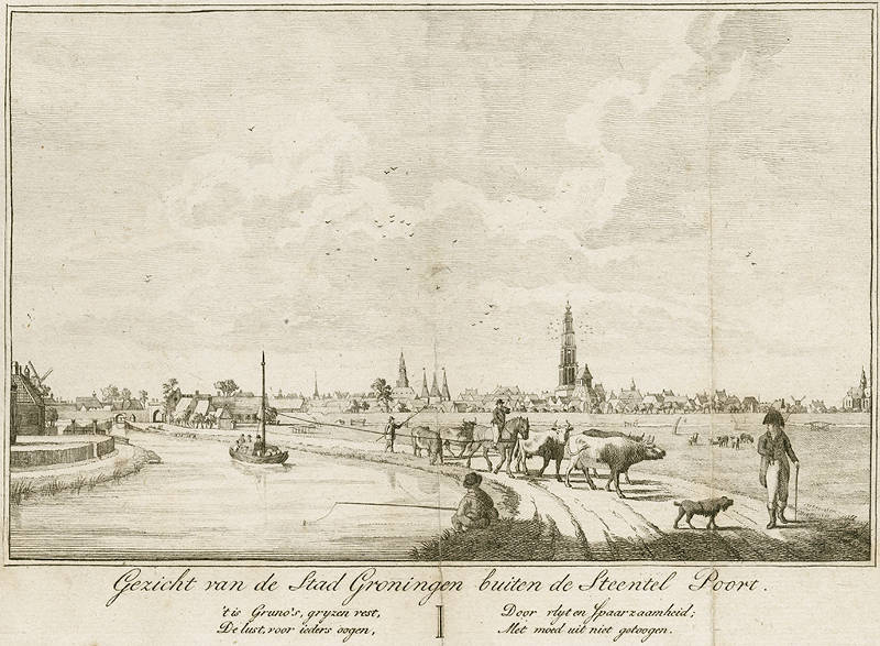
Date: 1813 (presumably the year of the original drawing)
by Haatje Pieters Oosterhuis
The construction of extensive dijkenstelsel (dike systems) as also critical during this period. These dijken (dikes) were essential for protecting the reclaimed lands from the sea and preventing the catastrophic floods that could occur during storm surges. Alongside the dikes, the Dutch engineered a kanalenstelsel (network of canals) that facilitated not only transportation and communication across the burgeoning nation but also played a crucial role in controlling water levels and distributing freshwater. The Dutch engineered a series of sluizen (locks; in Dutch singular sluis), dikes, and drained landscapes to manage water levels and prevent flooding, which in turn facilitated the smooth operation of the trekschuit (tow bardge) routes (trevaarten in Dutch). Tow boats were pulled along canals by horses walking on trekvaarten, were an efficient and popular transport solution, pre-dating the railway era and reflecting the Dutch mastery in both hydraulic engineering and transportation. This innovation was closely tied to their sophisticated water control systems, crucial in a country where much of the land is below sea level.
Sluizen (sluices),A sluice is a vital water management device that functions as a movable gate within a water channel, such as a river or canal, allowing for the regulation of water flow, control of water levels, and management of water discharge. Essential in applications such as agricultural irrigation, flood prevention, and land reclamation, sluices enable the precise manipulation of water to maintain optimal conditions for various uses. They are especially crucial in canal lock systems, helping to adjust water levels to facilitate the passage of boats between areas of differing elevations. Through their ability to control water efficiently, sluices contribute significantly to managing natural water resources and protecting landscapes from flooding and erosion. or water-regulating gates, were another important invention of the time, used to manage the flow and level of water in the canals and rivers. This regulation was vital to maintaining the integrity of the polders and ensuring that these areas remained dry and habitable.

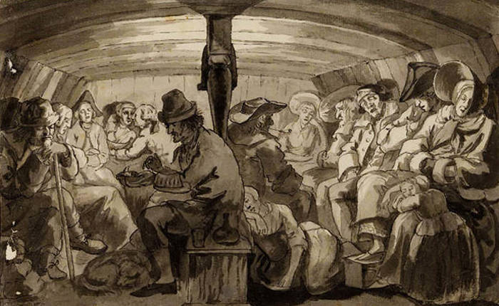 Inside a trekschuit
RESOURCES
- Table of Vermeer's Paintings (sortable)
- Vermeer's Paintings in Scale
- Vermeer Signatures
- Vermeer Dates
- Vermeer's Family Tree
- Timeline of Delft
- Hi-Res Images of Vermeer's Paintings
- Ongoing Vermeer Events
- Complete Vermeer Bibliography (sortable)
- Complete Vermeer Exhibitions (sortable)
- Vermeer's Techniques & Materials
- Primary Resources
- Perspective Manuals
- Camera Obscura
Bibliographies
Looking Over Vermeer’s Shoulder
The complete study of Vermeer’s materials, artistry and painting techniques
Jonathan Janson
(painter & founder of Essential Vermeer.com)