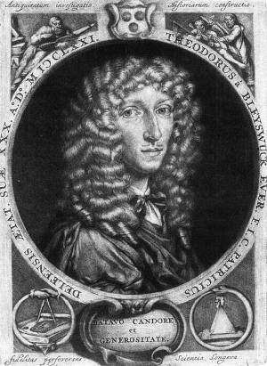
This map is notable for its depiction of Delft and its array of significant public buildings. It has been frequently republished and modified, with its side views incorporated into the second edition of Bleyswijck's Beschryvinge der Stadt DelftVan Bleyswijck is most famous for his book "Beschryvinge der Stadt Delft" (Description of the City of Delft), first published in 1667. This work is an extensive account of the history, institutions, notable figures, and buildings of Delft. It provides valuable insights into the city during the 17th century and is considered an important source for historians studying this period and region. Dirck van Bleyswijck maintained a somewhat an ambiguous and problematic attitude to the medieval history of Delft . and Boitet's expanded version in 1729.
The Delft painter Johannes Verkolje (1650–1693) contributed drawings of the church buildings and a panoramic cityscape. Jacob Spoors, a surveyor, led the team responsible for providing updated measurements to refine Blaeu's earlier map. Johannes de Ram was tasked with the map's engraving.
Dirck van Bleyswijck, in the midst of his life's work, published the first part of Beschryvinge der stadt Delft and followed with the second part in 1680, a year before his death. In 1675, he undertook the city council's commission to create the Kaart Figuratief, offering a bird's-eye view of Delft. The map's measurements were taken by surveyor Jacob Spoors, (1595–1677),Spoors began his professional career as a surgeon in his native Delft in 1614, the very year that the Anatomy Theater was founded. 22 It may be assumed that he regularly attended lectures there about medicine, optics, mathematics, and the arts. Perhaps inspired by these discussions, Spoors decided to change careers and to become a surveyor and notary. who would become a particularly important individual in Vermeer’s network of friends and colleagues interested in exploring the natural world through art, science, mathematics, and optical devices.David de Haan, Arthur K. Wheelock Jr., Babs van Eijk, and Ingrid van der Vlis, Vermeer's Delft (Zwolle: Waanders Uitgevers, Museum Prinsenhof Delft, 2023), 59. Johannes de Ram and Coenraet DeckerDe Ram and Decker were prominent figures in the seventeenth-century Dutch cartography and engraving scene. De Ram, based in Amsterdam, was an accomplished engraver and publisher. He is particularly noted for his work on various maps and atlases. His expertise in engraving was crucial for the Kaart Figuratief project, where he was responsible for the actual engraving of the map. This task required a blend of artistic skill and technical accuracy, essential for translating detailed drawings and measurements into a finely engraved map ready for printing. Decker worked alongside de Ram, sharing the responsibility of engraving the copper plates used for the Kaart Figuratief. His role was similar to de Ram's, involving meticulous and precise engraving work. engraved the copper plates, and the printing was managed by Amsterdam publisher Pieter Smith in an unspecified edition. Concurrently, twenty-eight peripheral prints, mostly depicting key buildings and monuments, were released. When assembled on linen as instructed, these prints and the map form an impressive wall decoration spanning nearly four square meters.
Jan Verkolje
1671
Mezzotint print, 17.4 x 13.3 cm.
Private collection
Due to its success, the city council authorized a reprint of two hundred copies in 1703, updating the original copper plates to reflect the contemporary cityscape. Changes included replacing the cemetery wall of the Nieuwe Kerk (New Church) with trees and posts, updating the Armamentarium with its new 1691–1693 building, and removing the depiction of the Roosmolen, which had been relocated in 1679. The City Archives' version of the Kaart Figuratief holds a unique status, especially in its depiction of the Roosmolen, and this remains unchallenged until an alternative version is discovered.
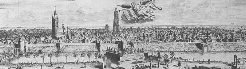
The Kaart Figuratief is undoubtedly the most important map of Delft, a "true topographical monument."Bert van 't Hoff, Oude plattegronden van de stad Delft (Rotterdam; Den Haag: 1962), 10. However, it is not a map in the modern sense, rather, it is a hybrid of a map, an aerial photograph, and theater stage in which the whole town of Delft is seen from a bird's-eye view with buildings shown in isometric perspective. The drawing's three-dimensional relief offers an unparalleled sensation of a real brick-and-mortar town in miniature and it is difficult not to be moved by it. Beautiful as the Kaart Figuratief may be, it still has one drawback for the modern historian: it depicts a smaller number of buildings on any given city block than there actually were. Bas van der Wulp, "A View of Delft in the Age of Vermeer," in Dutch Society in the Age of Vermeer, eds. Donald Haks and Marie Christine van der Sman (Zwolle: Waanders Books, 1996). Thus, exact measurements and identifications of specific building is not always possible, especially in the positions of some minor streets and individual buildings, but the surveying is done with care. Additionally, it does not show the improvised wood structures where the poor resided in the areas immediately surrounding the walled town. However, in general, the Kaart Figuratief is extremely informative and detailed for its period.
Click here for more information on the Kaart Figuratief and other historic maps of Delft.
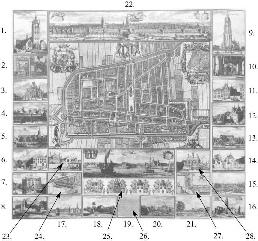
Click on the links to access a large image of the corresponding map-section.
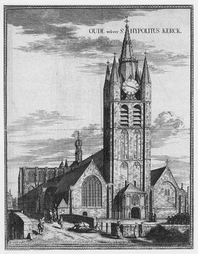
- Oude Kerk (Old Church)
- Tomben der Admiralen (tombs of the admirals Maarten Tromp and Piet Heyn)
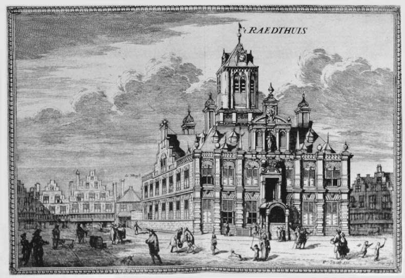
- Stadhuis (Town Hall)
- Oude Princen Hof (Old Prinsenhof)
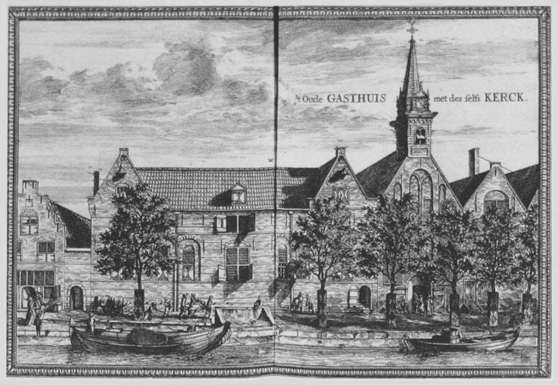
- 't Gasthuys ('Guest-House'. Originally (Middle Ages) guest-house and hospital of the Norbertiner-convent Koningsveld, se also no. 16. After 1572 (Reformation) municipal hospital of Delft. In 1625 united with the 'Pest-Huis'/Plague-House, see no. 13)
- Vlees-Hal (Meat-Hall)
- Amunitie Magasijn van Holland (central armory for the region Holland and
Westfriesland.) - Generaliteits Kruys Magasijn (new gunpowder magazine of the
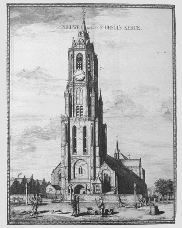
'Generaliteit van de Staten Holland en West-Friesland') - Nieuwe Kerck (New Church)
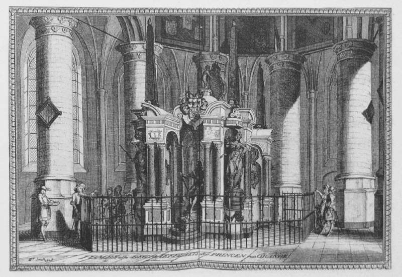
- Tombe der Princen van Orange (tomb of the princes of Orange)
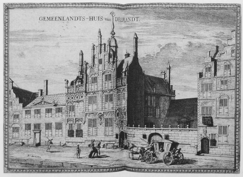
- 't Gemeendlands Huis (Gemeendlandshuis, since 1645 house of the'Hoogheemradschaap van Delfland', the regional Water & Dyke Board)
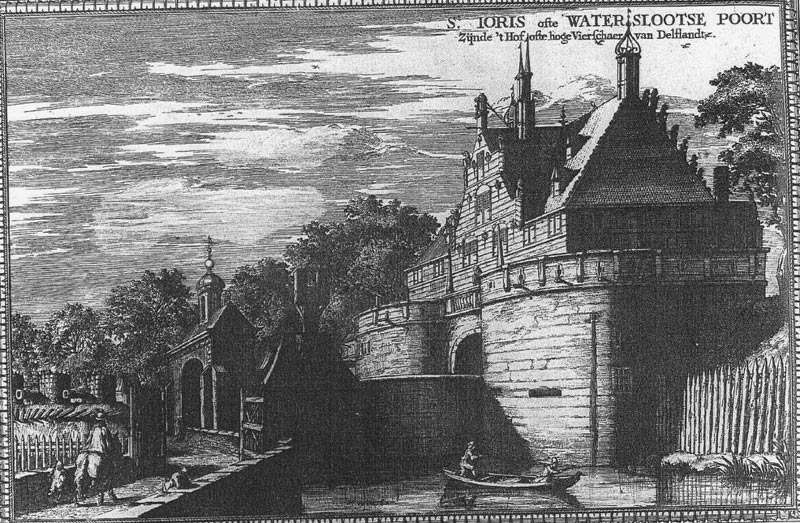
- 't Hof, ofte hooge Vierschaer van Delftlands (house of the High Court of Delftland)
- 't Pest-Huys (Plague-House; former Mary Magdalen Convent)
- Stads Doele (shooting range of the Delftse Schutterij/Civic Guard)
- Artillery Magasijn van Holland (Artillery Depot of Holland)
- Abdye Konings-velt (ruin of Kingsfield Abbey)
- Overschie in Profijl (Overschie in profile, township north-east from Schiedam, at the Delfshavenschie)
- Stads Tol-heck by Berckel (municipal customs house)
- short description of the map
- Leydschendam (village between The Hague and Leiden, near Voorburg)
- Voorburg in Profijl (village near The Hague)
- Die Stadt in Profijl ofte verschictieuwe (The city in profile)
- Stads-huys oop Delfshaven (Town Hall of Delfshaven)
- Delfshaven in Plano (top view/map of Delfshaven)
- Wapen der Heeren Burge-meesteren (emblems of the Mayors/burgomasters)
- Delfshaven in Profijl (Delftshaven in profile)
- Overschie in Plano (map of Overschie, township north-east from Schiedam, a the Delfshavenschie)
- Zee-Magasijn van d' O. I. Comp. (sea-magazine/warehouse of the Vereenigde Oost-Indische Compagnie (United East-Indian Company)